Ojibwa Sugar Camp Trail
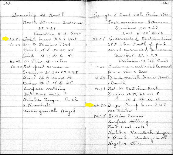
Image below the map is from the 1862 field notebook of the surveyor identifying the location of the Ojibwa Sugar Camp and the trail .

The yellow marks on the 1862 surveyor journals gives the coordinates for the portage trail and sugar camp on WinMan properties.
Both the portage trail between Rest and South Turtle Lakes and the Ojibwa sugar camp are on the WinMan Trails properties. Those interested in discovering these cultural resources should stay tuned for updates, because the Manitowish Waters Historical Society and WinMan Trails will collaborate on developing documents and possible access to these sites.

Seth Eastman was a 19th century artist attached to the Army who chronicled American Indians with vivid images. This 1853 image illustrates a spring sugar camp similar to the site between Rest and South Turtle Lakes on the maps.

The maps below illustrate the historic portage trail and sugar camp trail as an overlay of a modern map of the area, including the WinMan trails.

